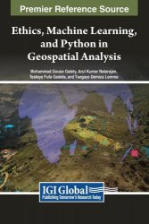
 Название: Ethics, Machine Learning, and Python in Geospatial Analysis
Автор: Mohammad Gouse Galety, Arul Kumar Natarajan, Tesfaye Fufa Gedefa, Tsegaye Demsis Lemma
Издательство: IGI Global
Год: 2024
Страниц: 359
Язык: английский
Формат: pdf (true), epub
Размер: 26.8 MB
In geospatial analysis, navigating the complexities of data interpretation and analysis presents a formidable challenge. Traditional methods often need to efficiently handle vast volumes of geospatial data while providing insightful and actionable results. Scholars and practitioners grapple with manual or rule-based approaches, hindering progress in understanding and addressing pressing issues such as climate change, urbanization, and resource management. Ethics, Machine Learning, and Python in Geospatial Analysis offers a solution to the challenges faced by leveraging the extensive library support and user-friendly interface of Python and Machine Learning. The book's meticulously crafted chapters guide readers through the intricacies of Python programming and its application in geospatial analysis, from fundamental concepts to advanced techniques.
The chapters within this book span a diverse range of topics, each meticulously crafted to provide readers with a holistic understanding of the subject matter. From examining the ethical dimensions of GIS data privacy to mastering geospatial analysis with Python, each Chapter contributes to a nuanced field exploration.
The initial chapters (Chapter. 1, Chapter. 2, and Chapter. 3) critically examine the ethical implications of geospatial data privacy, providing readers with a framework for navigating ethical dilemmas in collaborative environments. Building upon this foundation, subsequent chapters delve into the technical intricacies of geospatial analysis using Python, offering comprehensive overviews of Python libraries, data storage and management techniques, and advanced Machine Learning methodologies (Chapter. 4 to Chapter. 9).
Furthermore, this book goes beyond theoretical discussions, offering practical guidance on harnessing the power of Python programming for real-world problem-solving. Chapters dedicated to Machine Learning applications in geospatial analysis (Chapter. 8, Chapter. 9, and Chapter. 10) equip readers with the tools and techniques necessary for enhancing spatial understanding and decision-making.
Additionally, including specialized applications, such as big data analytics and topological insights into weather dynamics (Chapter. 11 and Chapter. 12), further underscores the breadth and depth of topics covered in this volume.
This chapter serves as a valuable resource for Computer Science enthusiasts, researchers, and practitioners seeking an understanding of geospatial analysis with Python. Python is a broadly utilized general-purpose dynamic computer language. Python has been utilized in different disciplines due to its framework of modules, simple expansion, excellent graphics, object-oriented programming support, simple learning, fast development times, suitability for high-performance applications, and free download. The chapter begins with an introduction to geospatial analysis, highlighting the significance of geospatial data across various domains. It establishes Python’s stand in this field, positioning it as a powerful tool for geospatial analyses. The subsequent sections explore fundamental concepts, such as vector versus raster data, coordinate reference systems and projections, geometric objects, topological relationships, and spatial operations. Further, prominent Python libraries for geospatial analysis are explored. GeoPandas is introduced, detailing its capabilities in working with geospatial data, handling geometric data structures, and leveraging spatial operations. Shapely is examined for its role in geometric manipulations. Fiona is explored as a library for handling geospatial data. Discussion on Folium showcases its utility in creating interactive and customized maps.
Machine Learning can play a critical role in geospatial analysis, providing enhanced computing efficiency, flexibility, and scalability, improved predictive capabilities, complicated problem resolution, and information extraction from big datasets. Python has emerged as the predominant language for geospatial Machine Learning due to its user-friendly interface, extensive library support, and versatility. This chapter has explored a diverse ecosystem of Python libraries ranging from Geopandas, Fiona, Leafmap, Geemap, PySAL, and Shapely for geospatial data manipulation to Keras Spatial, TorchGeo, Scikit-learn, and TensorFlow for Deep Learning applications. Complementing this, it also explored a variety of QGIS Python plugins that enhance geospatial machine learning capabilities, including smart-map, cluster analysis, PyQGIS, ClusterPoints, AI vectorizer, mapflow, deepness, and many more, offering functionalities for digital mapping, clustering, and map segmentation.
Contents:
Скачать Ethics, Machine Learning, and Python in Geospatial Analysis
[related-news] [/related-news]
Комментарии 0
Комментариев пока нет. Стань первым!


