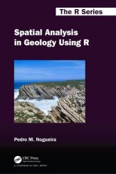
 Название: Spatial Analysis in Geology Using R
Автор: Pedro M. Nogueira
Издательство: CRC Press
Серия: The R Series
Год: 2024
Страниц: 452
Язык: английский
Формат: pdf (true)
Размер: 25.5 MB
The integration of geology with Data Science disciplines, such as spatial statistics, remote sensing, and geographic information systems (GIS), has given rise to a shift in many schools, pushing the boundaries of knowledge and enabling new discoveries in geological processes and earth systems. Spatial analysis of geological data can be used to identify patterns and trends in data, to map spatial relationships, and to model spatial processes. R is a consolidated and yet growing statistical programming language with increasing value in spatial analysis often replacing, with advantage, GIS tools. By providing a comprehensive guide for geologists to harness the power of spatial analysis in R, Spatial Analysis in Geology Using serves as a tool in addressing real-world problems, such as natural resource management, environmental conservation, and hazard prediction and mitigation. With a free and open-source software environment that is well-suited for spatial data analysis, it has a wide range of statistical and graphical functions that are easy to learn and use.
This book is intended to provide a hands-on introduction to spatial analysis in geology using R. It is aimed at people who have acquired elementary spatial analysis skills often using GIS but who are interested in deepening their skills. The book will also be of interest to graduate students and researchers who are interested in using R for spatial analysis in geology.
There are a number of reasons why you might want to use R for spatial analysis. R is a free and open-source software environment, which means that it is available to everyone, with a plethora of statistical and graphical functions. Additionally, R is very easy to learn and use, even if you do not have any prior programming experience.
Features:
· Provides a practical and accessible overview of spatial analysis in geology using R
· Organized in three independent and complementary parts: An Introduction to R; Spatial Analysis with R; and Spatial Statistics and Modelling
· Applied approach with many detailed examples and case studies using real geological data
· Presents a collection of R packages that are useful in many geological situations
· Does not assume any prior knowledge of R; all code is explained in detail
· Supplemented by a website with all data, code, and examples
Part I of the book introduces the R programming language, its libraries, methods, and functions (Chapter 2); on how to read and write data (Chapter 3); basic operation for data cleaning (Chapter 4); common R function (Chapter 5); basic statistics with R (Chapter 6); and basic data visualisation with R (Chapter 7). The format of this part is mostly designed to be used as a reference text. This is neither a computer programming book nor a thorough description of all the possibilities of the R programming language; however, when convenient I recommend complementary readings. The operations and functions selected are the ones that are most commonly used in a typical R session from a geologist’s point of view. It has a chapter dedicated to data visualisation, an important task in spatial data analysis.
Part II covers a range of spatial objects and methods (Chapters 10 and 11) used in spatial analysis; for those acquainted with GIS, some parts will sound familiar but often surprisingly twists on new ways to handle spatial data (Chapters 12 and 15) are presented.
Part III is dedicated to what often is called geostatistics, including point pattern analysis (Chapter 20), spatial autocorrelation and spatial interpolation (Chapters 21 and 22), and spatial regression. It is founded on several case studies demonstrating the application of R and its advanced analysis tools.
The book does not assume any prior knowledge of R. All of the code in the book is explained in detail so that readers can follow along and learn how to use R for spatial analysis. The code is presented as code fragments or snippets named sequentially by chapter, exercise, and chunk.
Spatial Analysis in Geology Using R will be useful to any geological researcher who has acquired basic spatial analysis skills, often using GIS, and is interested in deepening those skills through the use of R. It could be used as a reference by applied researchers and analysts in public, private, or third-sector industries. It could also be used to teach a course on the topic to graduate students, or for self-study.
Скачать Spatial Analysis in Geology Using R
[related-news] [/related-news]
Комментарии 0
Комментариев пока нет. Стань первым!
